
GOLD CANYON AREA PARKS, TRAILS AND OUTDOOR INFORMATION
Gold Canyon Arizona is a newer, well-maintained unincorporated city in Pinal County about 45 minutes east of the Phoenix Sky Harbor airport. The area is considered by many as an upscale East Phoenix Valley community that has many affordable homes. Gold Canyon is adjacent to the Superstition Mountain Wilderness and at the foothills of Superstition Mountain, which offers thousands of square miles of public land for hiking, bike riding, photography, camping and other outdoor sports.
City of Apache Junction Parks and Recreational Facilities
The City of Apache Junction offers up a number of recreational and outdoor activity venues. These include Complex Park, Flatiron Park, Prospector Park, Superstition Shadows Park, Veteran’s Memorial Park, Dutchman Dog Park, Little League Complex, Skate Park, the Multi-Generational Facility, and the Rodeo Park Event Center.
Link to information on these City of Apache Junction Recreational Facilities, including usage requirements, rules and regulations, reservations, and permits can be found at the city’s website: https://www.apachejunctionaz.gov/111/Parks-Recreation
Of special note, because of its proximity to Gold Canyon, Silly Mountain is included in this list.

Silly Mountain Entry Sign
Silly Mountain is a very popular park facility located along the US 60 near Gold Canyon, AZ. The park is well-maintained, and has a number of trails of varying difficulty including an interpretive trail. Restroom facilities and parking are provided at the park.

Silly Mountain
View of Silly Mountain Wildflowers
Pinal County Parks and Recreational Facilities
Pinal County operates a number of wonderful facilities that support a variety of recreational and outdoor activities. These facilities are listed below, and many have features that can be reserved for family and group activities (see links for details).
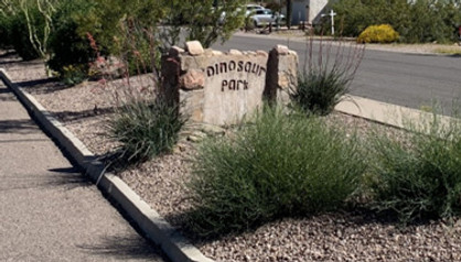
Dinosaur Park entryway sign & parking
Dinosaur Park
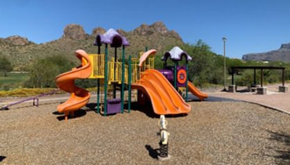
Dinosaur Park is a small County Park, located at 5622 S. Alameda Road, Gold Canyon, Arizona managed under the auspices of the Pinal County Open Space and Trails Department. The Park is located adjacent to Gold Canyon Dinosaur Mountain (from which the Park received its name), and is a facility where locals and visitors can relax and enjoy the serenity of this superb County Park. The park has ample parking, ramadas that can be reserved for events, a short trail, and playground equipment. There is also a butterfly garden adjacent to the park maintained by local master gardeners.
Dinosaur Park Playground Equipment
(Dinosaur Mountain in the background)
Peralta Regional Park
Peralta Regional Park is situated in the incredible Superstition Mountains and has the following amenities:
-
Equestrian Staging Area
-
9+ miles of multi-use non-motorized trails with varying difficulty
-
18 Picnic Sites and 2 Large Group Picnic Sites
-
Stargazing Node for setting up a telescope
-
31 Remote Campsites
-
Interpretive trail with educational panels
-
Waterless Restrooms
Please note: The park has no electricity, water, or trash service, so campers must pack in what they need and pack out all waste.

Entrance to the Peralta Regional Park
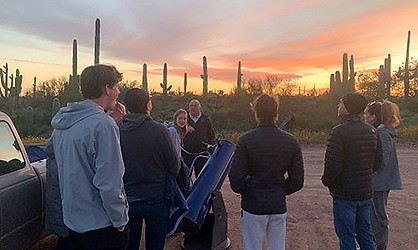
Stargazing Event at Peralta Regional Park
Upcoming Projects
Central Arizona Project (CAP) National Recreation Trail
The Central Arizona Project (CAP) Trail is an emerging vision to create a recreational trail (long-distance, non-motorized, multi-use recreational trail) corridor stretching the entire 336 miles of the Central Arizona Project canal. The trail will serve a broad population and represents a key link to major trails within the state.
A big concept in the planning stages would use the right-of-way of the Central Arizona Project (CAP) from the California state line to Tucson. The 336-mile route is a major water supply from the Colorado River near Lake Havasu to farms and homes across urban Arizona. The canal is owned by the U.S. Bureau of Reclamation.
In Pinal County, the CAP Trail will be almost 100 miles in length and will connect the communities of Red Rock, Eloy, Coolidge, Florence, and Apache Junction